Waikato Region 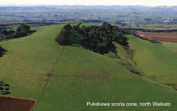
Ahuroa Ignimbrite section. Map: T16; Classification: C3. Significance:
Section through intensely welded ignimbrite with 'inverse' cooling gradient,
erupted from Mangakino volcano.
Albatross Point, Kawhia Coast Jurassic
sediments and syncline. Map: R15; Classification: B3. Significance: Reasonably
well exposed syncline showing geomorphic expression of dip slopes.
Anaomaki Point volcanic
section. Map: R15; Classification: C3. Significance: Well preserved
section of the Orangiwhao Volcanics.
Aotea dune fields. Map: R15; Classification:
B2. Significance: A large area of mobile dune fields - the biggest example on
the west coast of the
Arapuni type ignimbrite,
Aratiatia rapids.
Map: U17; Classification: B2. Significance: An impressive stretch of rapids,
the
Atiamuri Geothermal Field.
Map: U16; Classification: C2. Significance:
Atiamuri Ignimbrite section. Map: U17;
Classification: C3. Significance: Type locality for Atiamuri Ignimbrite.
Atiamuri lake break-out-flood boulders. Map:
U17; Classification: C1. Signifiance: Most easily accessible large boulders
from the break-out flood of Lake Taupo following the lake level rise after the
Oruanui eruption, 26,000 yrs ago. Illustrates the enormity of
the flood that would have thundered down the
Awaiti dune field. Map: T13; Classification: C1. Significance:
Unusual inland pumiceous sand dunes formed by fluvial and aeolian processes.
Awakino Gorge Mesozoic section. Map: R17;
Classification: C3. Significance: Important Triassic - Jurassic section for
invertebrate and pollen stratigraphy.
Awakino Gorge Miocene fossils. Map: R17;
Classification: C3. Significance: Type locality of several Otaian molluscs
described by Laws. One of few early Miocene faunas from this
part of
Awakino Gorge tunnel Oligocene and Miocene
record. Map: R17; Classification: C3. Significance: Most easily seen and one of
the best exposed sequences recording the Oligocene and Miocene sedimentary and
tectonic history of north Taranaki.
Bald Spur volcanic breccia, Mt Pirongia. Map:
S15; Classification: C3. Significance: Good exposure of Pirongia Volcanics.
Big Bay blowhole, Hahei.
Map: T11; Classification: C3. Significance: Largest blowhole on Coromandel
Peninsula.
Bluff Road volcanic cone. Map: R12;
Classification: C3. Significance: Small volcanic centre, forming prominent
hill.
Boat Harbour, Lake Taupo. Map: T18; Classification: C3. Significance:
Bradfield's "Lindern Hills" quarry
Jurassic fauna. Map: R16; Classification: B2. Significance: Rich lower Temaikan
mollusc and brachiopod fauna. Rather weathered but still best Temaikan fauna in
New Zealand.
Broadlands (Ohaaki) Geothermal Field. Map:
U17; Classification: C1. Significance:
Broken Hills mordenite.
Map: T12; Classification: C2. Significance: A particularly good exposure of
mordenite.
Buck Rock,
Castle Craig bluffs, Marokopa. Map: R16;
Classification: C3. Significance: Impressive
isolated citadel surrounded by high bluffs. One of only a few good examples in
region, near the road, of bluffs not masked by forest. Well developed karst
landscape on top of citadel.
Castle Rock volcanic plug. Map: T11;
Classification: C3. Significance: A spectacular rock outcrop formed by erosion
around a resistant volcanic plug.
Cathedral Cove, Hahei. Map: T11;
Classification: B2. Significance: Spectacular coastal arch beneath headland;
isolated stack (Te Horo Rock), impressive cliffs of white ignimbrite. Major tourist attraction.
Chimp ignimbrite section. Map: T16; Classification: C3. Significance: Type
locality for Chimp ignimbrite.
Crown battery, Karangahake.
Map: T13; Classification: A2. Significance: In 1889 New Zealand Crown Mines
became the first company in the world to use the MacArthur-Forrest cyanide
process to extract gold and silver from ore on a commercial scale. The Crown
mine was the fourth largest producer in the Hauraki goldfield.
Daff Road Jurassic plant
beds. Map: R13; Classification: B2. Significance: Most easily accessible
and most robust source of extremely well reserved Jurassic plant beds of
Huriwai Formation.
Darkie Stream tourmaline. Map: S10;
Classification: C3. Significance: A good and easily accessible example of
tourmaline.
De Bretts tephra section. Map: U18; Classification: B3. Significance:
Well-publicised section through near-complete sequence of post-10 ka Taupo
deposits.
Dunphail Bluffs Oligocene sandstone. Map: S14;
Classification: C3. Significance: Type section for Glen Massey Formation and
its members.
Elephant Cove eroded crater,
Fan Rock,
Five
Fletchers Bay Waitemata
Group sediments, northern
Frenchmans Cap old hat islet,
Hahei rhyolite dome. Map: T11; Classification: C3. Significance:
Complete coastal section through rhyolite dome.
Halfway Road tephra section. Map: U19;
Classification: B3. Significance: Shows the two-layer subdivision of the Taupo
ignimbrite.
Haparangi lava dome. Map: U16; Classification: C3. Significance: Prominent
200 m high rhyolite dome within the Kapenga caldera.
Hautapu Hill Oligocene sediments. Map: R15;
Classification: C3. Significance: Best exposure of Aotea Formation in the
Kawhia area, with Whaingaroa Formation beneath and Ohahiri Limestone above.
Helictite Hole, Whatawhata. Map: S14;
Classification: C1. Significance: Speleothems, in particular helictites.
High
Hinuera Gap. Map: T15; Classification: B3. Significance: The
eroded gap through which the
Hipaua landslide. Map: T19; Classification: C3. Significance: A
large and active example of a landslide. Movements are thermal initiated and
dated.
Horahora hydro-electric
power station. Map: T15; Classification: C5. Significance: The site of
the first hydro-electric power station on the
Horehore lava dome. Map: T19; Classification: C3. Significance:
Isolated youthful lava dome.
Horohoro Geothermal Field. Map: U16;
Classification: C2. Significance:
Horohoro lava dome and bluffs. Map: U16;
Classification: C3. Significance: 300 m high, very prominent intra-caldera
rhyolite dome within the Kapenga caldera, truncated on the eastern side by
faulting, leaving 6 km of near vertical rhyolite cliffs.
Horomatangi reef Taupo eruption vent. Map: T18;
Classification: A3. Significance: Inferred site of 1850 a Taupo eruption vent.
Hot
Huka Falls. Map: U18; Classification: B2.
Significance: An impressive tourist attraction, the
Huriwai Beach Jurassic plant
beds. Map: R13; Classification: B2. Significance: Extremely
well-preserved and historically significant upper Jurassic flora. Type locality
of several species.
Huriwai-Waikawau coastal section
JurassicOligocene unconformity. Map: R13; Classification: C3. Significance:
Oligocene rocks and unconformity; diverse topmost Jurassic macroflora.
Kaawa Creek -
Kaiapo Fault 1922 and 1983 displacements. Map:
U18; Classification: C2. Significance: Holocene scarp with 1922 (1 m) and 1983
(50 mm) displacement (SE side up and 30 mm extension. 1200 m of 1983 trace,
typically left stepping en echelon tension cracks. Composite focal mechanisms
showed significant RL and LL strike slip components for earthquake and swarms
respectively. Example of E bounding fault of Taupo Rift. Displaces 300000 year
Rhyolite. [ Note: 1983 displacement may have been largely obscuredlevelled by
now.] This site is monitored for precise strain measurements by the Earth
Deformation Section,
Kai-iti Point porphyrite.
Map: S09; Classification: C3. Significance: Well exposed coastal section
through the type intrusion.
Kaimanawa Schist. Map: T20; Classification: C3. Significance: The
only area of Torlesse-derived schist in the
Kaimango Road Jurassic
fossil locality, Kawhia. Map: R16; Classification: B3. Significance:
Holostratotype of Mangaoran Substage.
Kakaramea Fault. Map: T19; Classification: C3.
Significance: Late Quaternary displacement of 18.4 m (W side up) motion on the
Kakaramea Fault.
Kakaramea-Tihia composite volcano. Map: T19; Classification:
C3. Significance:
Late Quaternary andesite composite volcano within
Kakepuku volcano.
Map: S15; Classification: C3. Significance: Prominent volcanic cone visible
from wide area and with public walking track to scenic view point on top.
Kakuki basalt. Map: U17; Classification: C3.
Significance: Eroded scoria cone erupted from Maroa volcano.
Kapanga gold discovery site. Map: T10;
Classification: B3. Significance: Site of the first authenticated discovery of
gold in
Karangahake Gorge section.
Map: T13; Classification: C3. Significance: Impressive gorge superimposed
through the uplifted
Karangahape basalt. Map: T18; Classification: C3. Significance: Well
exposed Strombolian monogenetic centre associated with Taupo volcano.
Kauaeranga Gorge. Map: T12; Classification:
C3. Significance: A deeply incised gorge with near vertical sides extending 300
m above the river.
Kauri Road scoria cone.
Map: R13; Classification: C3. Significance: Small volcanic centre.
Kawaroa Anticline.
Map: R15; Classification: C3. Significance: Exposure of a component of the
Kawhia Regional Syncline.
Kawhia coastal karst. Map: R15; Classification: B2.
Significance: One of the most spectacular examples of coastal karst in
Kawhia (Te Puia) hot springs. Map: R15;
Classification: C2. Significance:
Kellyville Crater diatomite.
Map: S12; Classification: C1. Significance: Possibly best example in
Kellyville Crater tuff.
Map: S12; Classification: C2. Significance: One of the best and most easily
accessible exposures of volcanic tuff in the South Auckland Volcanic Field.
Kellyville tuff ring. Map: S12;
Classification: B3. Significance: One of
Kerepehi Fault,
Kerepehi Fault, Matamata. Map: T14; Classification: C3. Significance: Late
Quaternary displacement along the Kerepehi Fault. 6 m steep scarp with vertical
= 7.4 m and dextral offset of channel bar by 22 m (1.3 mmy).
Kerepehi Fault,
Kerepehi Fault, Taihoa N and
S Roads intersection. Map: T14; Classification: C3. Significance: Late
Quaternary displacement along the Kerepehi Fault. 6 m scarp with at least 3
discrete fault planes and terracemeander offset, indicating possible strike
slip-progressive displacement. Exposure on
Kerepehi Hot Springs. Map: T12;
Classification: C1. Significance:
Ketetahi Geothermal Field. Map: T19;
Classification: A2. Significance: Only vapour-dominated geothermal system in
Kiritehere Coast Upper
Triassic section. Map: R16; Classification: B3. Significance: Continuous
exposure of Upper Triassic to basal Jurassic strata; includes stratotypes of
Warepan substages; well exposed examples of submarine slumps. Excellent series
of numerous zeolitised vitric tuff beds in sedimentary sequence. Important for invertebrate and pollen stratigraphy and best
Triassic sequence in the
Kiritehere Moeatoa
Conglomerate lowest Triassic sequence. Map: R16; Classification: B3.
Significance: Base of Triassic sequence; oldest Triassic strata in the
Kopouatai peat bog. Map: T13; Classification: B2. Significance:
Largest indigenous peat bog and wetland remaining in
Kopuku opencast Waikato Coal Measures. Map:
S12; Classification: C4. Significance: One of the best exposures of
fines-dominated Upper Waikato Coal Measures, and Kupakupa coal seam.
Koroi lava dome. Map: T19; Classification: C3. Significance: Very
young dacitic lava dome extruded within the last 1819 years BP.
Korotai Ignimbrite section. Map: T17; Classification: C3.
Significance:
Type locality for Korotai Ignimbrite.
K-Trig basalt. Map: U18; Classification: B3.
Significance: NNE-aligned basaltic scoria cones and tuff rings erupted from
Taupo Volcanic Centre.
Kuharua lava dome. Map: T19; Classification: C3. Significance:
Rhyolite lava dome extruded at SW margin of Taupo caldera.
Kupakupa coal mine. Map: S13; Classification:
C5. Significance: The first coal mine in the
Kuratahi Cave, Piopio. Map: R17; Classification: C2. Significance:
Speleothems - gypsum crystal trees, geomorphology - length, dendritic
development, old sedimentary deposits potentially useful for pollen research.
Lichfield Bank building.
Map: T16; Classification: C1. Significance: Earliest known building made of
ignimbrite.
Link Road ignimbrite section. Map: T17;
Classification: B3. Significance: One of only two known exposures of Ignimbrite
F.
Luck at Last battery, Whangamata. Map: T12;
Classification: C2. Significance: One of the best preserved battery sites on
Mahoenui coal mine. Map: R17; Classification: C3. Significance:
Excellent exposure of Mokau Formation and Maryville Coal Measures, with under
and overlying marine sandstones.
Manawaru Hot Springs. Map: T14; Classification: C2.
Significance:
Manganamu lava dome. Map: T19; Classification:
C3. Significance:
Very young dacitic lava dome extruded within the last 1819 years BP from SW
margin of Taupo caldera.
Mangaokewa ignimbrite section A. Map: S17;
Classification: A3. Significance: Rare exposure of contacts between some of the
Mangakino-derived ignimbrites, crucial in establishing unequivocable
stratigraphic relation.
Mangaokewa ignimbrite section B. Map: S17;
Classification: C3. Significance: Exposure of distal valley pond of Taupo
Ignimbrite which demonstrates the extreme variations between distal and
proximal deposits.
Mangaokewa ignimbrite section C. Map: S17;
Classification: B3. Significance: Exposure of base of Ignimbrite A resting on
Tertiary sediments.
Mangaokewa ignimbrite section D. Map: S17;
Classification: C3. Significance: Exposure of base of Ongatiti Ignimbrite
resting with a steeply dipping contact on weathered Tertiary sediments.
Mangaotaki
overhang, Piopio. Map: R17; Classification: C3. Significance: One of the best
natural overhangs developed in the region.
Easily visible from public road.
Mangapehi coal mine, Bennydale. Map: S17;
Classification: B3. Significance: First mine in
Mangapohue natural bridge. Map: R16; Classification: B3. Significance: A
local tourist feature.
Mangapohue QEII Reserve polygonal karst. Map:
R16; Classification: C3. Significance: An
easily accessible example of polygonal karst.
Mangatawai Stream tephra section. Map: T19;
Classification: B3. Significance: Type section for Ngauruhoe Tephra
Formation and Mangatawai Tephra Formation.
Mangatawhiri cone. Map: S12; Classification:
C3. Significance: Easternmost volcanic centre in the
Mangawara Stream meanders. Map: S13;
Classification: C3. Significance: Classic gravel bed stream with meanders,
ripples and pools. Meander wavelengths evidently related to different terrace
sites and peak flood discharges.
Mangawharawhara Stream natural bridges &
tunnels, Piopio. Map: R17; Classification: B2. Significance: Spectacular karst landscape including Mangawharawhara
Cavern, the largest tunnel in the
Mangawhitikau Gorge, Waitomo. Map: R16;
Classification: C3. Significance: Scenically attractive towering limestone
karst formations.
Maori Farm Nos 1 and 3 opencast mines,
Rotowaro. Map: S14; Classification: B4. Significance: One of the best exposures
of lower and upper
Marokopa Falls. Map: R16; Classification: C2.
Significance: Spectacular high falls flow over
greywacke bluff from level of Oligocene peneplain.
Marokopa River natural tunnel. Map: R16; Classification:
C3. Significance: Spectacular natural
tunnel about 300 m long. Largest natural
bridge feature in the
Marotiri basalt. Map: T17; Classification: C3. Significance:
Small Strombolian eruption of basaltic scoria and welded agglomerate from Taupo
volcano.
Martha Hill gold lode. Map: T13;
Classification: B1. Significance: Most productive Coromandel gold-silver
deposit.
Martha Mine No.5 pumphouse. Map: T13;
Classification: B2. Significance: Best preserved of only two remaining relics
of the most productive gold mine in
Maumaupaki dacite plug (Camels Back). Map:
T11; Classification: C3. Significance: Excellent example of a dacite plug.
Maunganamu lava dome. Map: U18;
Classification: C3. Significance: Rhyolite dome erupted from Taupo volcano.
Maungatautari Volcano. Map: T15; Classification: B3. Significance:
Large, prominent volcanic cone seen over large region.
Mercer, type Mercer
Sandstone. Map: S12; Classification: C3. Significance: Type section of
Mercer Sandstone, Waitemata Group. Outcrop of an important, largely subsurface,
unit in
Meremere, type Amokura
Formation. Map: S13; Classification: C3. Significance: Type section for
the Amokura Formation, Waitemata Group. Rare outcrop of an important subsurface
unit.
Miranda chenier plain
and coastal flats. Map: S12; Classification: A1. Significance: Internationally
important area for study of chenier plain development
in a tectonically stable progradational coast. Only known occurrence in the
world of a chenier plaingravel ridge association (in
conjunction with Whakatiwai gravel ridges).
Miranda
Moehau Summit andesite.
Map: S10; Classification: C3. Significance: Good exposures of Port Charles
Andesite hornfelsed by subjacent Paritu Pluton.
Moehau Summit diorite. Map: S10;
Classification: C3. Significance: Hypabyssal satellite of the Paritu Pluton.
Moeweka Quarry Jurassic fossils. Map: R13;
Classification: B3. Significance: Good Heterian molluscan and brachiopod fauna.
Mokai Geothermal Field. Map: T17;
Classification: C2. Significance:
Mokai Ignimbrite section. Map: T17;
Classification: C3. Significance: Type locality for Mokai Ignimbrite.
Motuoapa Hot Springs. Map: T19; Classification: C2.
Significance:
Motuoapa lava dome. Map: T19; Classification:
C3. Significance:
Prominent 120 m high rhyolite dome connected to
Motuopuhi lava dome. Map: T19; Classification: C3. Significance:
Isolated youthful lava dome.
Motutaiko Island lava dome. Map: T18; Classification: C3.
Significance:
Rhyolite lava dome, forming an island within
Motutara Peninsula Jurassic
and Oligocene sediments. Map: R15; Classification: B3. Significance:
Oligocene overlying peneplain on Upper Jurassic siltstones. Very rich fossil
locality in the Puaroan.
Mt Karioi Volcano. Map: R15; Classification:
B3. Significance: Large prominent volcanic cone visible from large surrounding
area.
Mt Pirongia Volcano. Map: S15; Classification:
B3. Significance: Largest volcano in western
New Kotuku Trig Pukewharangi
Hill Oligocene fossil locality. Map: R14; Classification: B3.
Significance: Hypostratotype of Whaingaroan Stage. Richly microfossiliferous,
well studied sequence through the Oligocene.
Ngakuru Fault
splinter. Map: U16; Classification: C3. Significance: Late Quaternary
NE trending scarp showing progressive vertical displacement of terrace
surfaces. Taupo T1 surface offset by c.5 m and older Hooker surface displaced
by >10 m (SE side up).
Ngangiho Fault. Map: T18; Classification: C3. Significance:
Prominent late Quaternary trace of the Ngangiho Fault, one of the NE trending
faults of the Taupo rift zone. Scarp height is 6.5 m, and sits within a fault
angle depression that displaces Taupo pumice alluvium. Fault generally
downthrown to the SE. This site is monitored for precise strain measurements by
the Earth Deformation Section, New Zealand Geological Survey.
Ngapuriri Natural Arch and surrounding karst,
Port Waikato. Map: R13; Classification: B2. Significance: Only known inland
example in New Zealand of a natural arch (ie. formed by wind erosion unlike
natural bridge formed by water erosion). Within a small area
of spectacular joint-controlled karst.
Ngaruawahia wadi.
Map: S14; Classification: C3. Significance:
Ngatamariki Geothermal
Field. Map: U17; Classification:
C2. Significance:
Ngatutura Point dissected eruptive centre. Map: R13; Classification: C3. Significance: Most impressive coastal landforms eroded into
columnar-jointed basalt in
Ngauruhoe 1975 fall deposits and block and ash
flows. Map: T19; Classification: A3. Significance: Deposits preserved from 1975
eruptions at Ngauruhoe, widely used as a reference example of Vulcanian events.
Ngauruhoe composite cone. Map: T19; Classification: A3. Significance:
Actively forming andesitic composite cone with the most recent eruption in
1975.
Ngauruhoe glacial trough. Map: T19;
Classification: C3. Significance: One of the best examples of a broad glacial
trough in the
Ngauruhoe historic lava flows. Map: T19;
Classification: A3. Significance: Well dated lavas from historical eruptions
from Ngauruhoe in 1870, 1949 and 1954-1955.
North Crater lava lake and welded agglomerate,
Tongariro. Map: T19; Classification: B3. Significance: Scoria cone and crater
of Tongariro volcano. A cooled lava lake infills North Crater, with an
explosion pit present on NW portion of the lava lake.
Ohaaki Pool hydrothermal sinter. Map: U17;
Classification: B1. Significance: Large boiling spring which was the principal
discharging feature in the field prior to exploitation. One
of the two best examples of a hydrothermal sinter of this type in
Ohakuri Ignimbrite section. Map: U16; Classification: C3.
Significance:
Type locality for Ohakuri Ignimbrite.
Ohinemuri-Waikino Gorge
section. Map: T13; Classification: C3. Significance: Excellent exposure
showing varied volcanic rocks juxaposed against each other.
Ohinewai Hot Springs. Map: S13;
Classification: C2. Significance:
Ohuka Plio-Pleistocene flora and carbonaceous
sandstone. Map: R13; Classification: C3. Significance: Carbonaceous sandstone
containing an unusual Myrtaceae and Acacia flora. Contains numerous Acacia
pollen grains and radiometrically dated basalt boulders, preserves back barrier
valley and flood plain lignite, and represents the southern equivalent of the
onset of Northern Hemisphere Glaciations.
Okauia Hot Springs. Map: T14; Classification:
C2. Significance:
Okete Quarry jointed basanite flow section.
Map: R14; Classification: C3. Significance: Spectacular section through
columnar jointed flow and type location of the Okete Volcanics.
Okoroire Hot Springs. Map: T15; Classification: C2.
Significance:
Omara spit. Map: T10; Classification: C2. Significance: A well defined barrier sandspit.
Onepoto volcanic cone. Map: R12;
Classification: C2. Significance: Distinct scoria cone, on basalt shield lavas.
Onewhero scoria cone.
Map: R13; Classification: C2. Significance: Prominent small scoria cone on
ridge crest.
Onewhero tuff ring.
Map: R13; Classification: B3. Significance: Largest tuff ring in the
OngahoroRound Hill lava domes. Map: U16;
Classification: C3. Significance: Two prominent rhyolite domes, 180 m and 70 m
high, within the Kapenga caldera.
Ongaroto Hot springs. Map: T17;
Classification: C2. Significance:
Ongaroto perlite. Map: T17; Classification:
C3. Significance:
A good exposure of perlite. Site of
Ongohi Stream delta,
northwest Coromandel. Map: S10; Classification: B2. Significance: One of
the best and least modified examples of rare classical delta shapes along the
coast of the
Opito Point basalts.
Map: T10; Classification: C3. Significance: Well exposed basalt plug.
Opuatia cliff Jurassic
fossils. Map: R13; Classification: B3. Significance: Rich, diverse and
well-preserved Temaikan molluscan and brachiopod fauna.
Orakeikorako Geothermal
Field. Map: U17; Classification: B2. Significance: 1) Only known
chalcedonic sinter in the volcanic region. 2) Prolific blue-green algae which
inhabit the cooled thermal waters. 3) Large collapse feature known as Ruatapu.
Orakeikorako, Artist's Palette. Map: U17;
Classification: B2. Significance:
Orakeikorako, Diamond Geyser. Map: U17;
Classification: B2. Significance:
Orakeikorako, Golden Fleece Terrace. Map: U17;
Classification: B2. Significance:
Orakeikorako, Rainbow Terrace. Map: U17;
Classification: B2. Significance:
Orakeikorako, Ruatapu cave. Map: U17;
Classification: B3. Significance:
Orakonui Ignimbrite section. Map: U17;
Classification: C3. Significance: Type locality for Orakonui Ignimbrite.
Orua Hot Springs (Hot
Oruanui Ignimbrite section A. Map: U19; Classification:
B3. Significance:
Section near base of large volume ignimbrite which is a 'type' example of a
pyroclastic flow deposit associated with phreatoplinian volcanism.
Oruanui Ignimbrite section B. Map: U19; Classification:
B3. Significance:
Section through upper part of large volume ignimbrite which is a
"type" example of a pyroclastic flow deposit associated with
phreatoplinian volcanism.
Otama relict dunes. Map: T10; Classification: C2. Significance:
Abandoned Pleistocene dune barrier. Classic example, the best
on
Oturere lava flow, Mt
Tongariro. Map: T19; Classification: C3. Significance:
Ouaha gullies and rills. Map: U18;
Classification: B2. Significance: A series of gullies and rills, unusual
because the gullies represent erosion occurring immediately after deposition of
ash. The gullies are now like large unfilled fossil gullies.
Paeroa Fault Scarp. Map: U17; Classification:
C3. Significance: 10 m scarps on early Holocene tephra and alluvial terrace
surfaces at base of 500 m Paeroa Fault scarp. Displaces 150,000 year
ignimbrites by SE side up normal faulting. Geothermal area in fault zone due to
increased permeability.
Paeroa Fault south end. Map: U17;
Classification: C3. Significance: Late Quaternary scarps at the S end of the
Paeroa RangeFault Zone. Scarps displace Wairoa Formation (<300,000 years) in
opposite sense (NW side up) to uplift of the
Paku rhyolite dome and
perlite locality. Map: T11; Classification: B2. Significance: Exposures
of a multi stage eruptive complex. Excellent quality perlite.
Papanui Point volcanics. Map: R15;
Classification: C3. Significance: Well exposed section through Okete Volcanics.
Paparata cone. Map: S12; Classification: C3.
Significance: Small scoria cone.
Parakiwai andesite necks. Map: T12;
Classification: C2. Significance: Outstanding example of columnar jointing.
Paritu granite quarry.
Map: S10; Classification: C2. Significance: Main source of 'Coromandel
Granite', a widely used building and monumental stone in
Paku tombolo, Tairua. Map: T11; Classification: C3. Significance: One of the most easily accessible and visualised
tombolos along the
Pauanui barrier spit. Map: T11; Classification: C2. Significance: Superb example of a large barrier spit made of
numerous dune ridges.
Pauanui eroded columnar jointing. Map: T12;
Classification: C3. Significance: Example of progression of different stages of
erosion of a columnar jointed lava flow.
Piarere turnoff alluvial
terraces. Map: T15; Classification: A2. Significance: One of the worlds best examples of alluvial terraces - also good
outcrops of ignimbrites, and small alluvial fans.
Pihanga volcano. Map:
T19; Classification: C3. Significance: Small andesite massif within
Pinnacles rhyolite neck.
Map: T12; Classification: C3. Significance: Well exposed rhyolite neck.
Pohaturoa rhyolite
pinnacle. Map: U17; Classification: C3. Significance: One of the
tallest and most prominent pinnacles of rhyolite lava in the Taupo Volcanic
Zone. Prominent scenic feature next to HWY 1.
Pokai Ignimbrite section. Map: T16; Classification: C3. Significance: Type
locality for Pokai Ignimbrite.
Pokeno scoria cone. Map: R12; Classification:
C2. Significance: Well preserved volcanic cone with some of the freshest scoria
in the
Pomarangai Road quarry Jurassic fossils. Map:
R16; Classification: C3. Significance: Rich Heterian brachiopod-gastropod
fauna. Type locality for Belemnopsis keari and only New Zealand Jurassic
barnacle.
Port
Port
Port
Poutu tephra section. Map: T19; Classification: B3. Significance: Type
section for Poutu Lapilli and Rotoaira Lapilli, and principal reference section
showing the alternation of Taupo rhyolitic tephras and andesitic tephras from
Tongariro.
Primary and secondary Taupo Ignimbrite
deposits. Map: U18; Classification: B3. Significance: Represents secondary
deposits of Taupo Ignimbrite.
Puaroa Creek, Kawhia Jurassic fossil locality.
Map: R16; Classification: B3. Significance: Holostratotype of Puaroan Stage.
Pukeahua Ignimbrite section. Map: U17; Classification:
C3. Significance:
Type locality for Pukeahua Ignimbrite.
Pukekaikiore lava dome. Map: T18; Classification: C3. Significance:
Rhyolite lava dome extruded on SW margin of Taupo caldera.
Pukekawa II basalt cone. Map: R13;
Classification: C3. Significance: Small volcanic centre on the Pukekawa Fault.
Pukekawa III scoria cone. Map: R13;
Classification: B3. Significance: Well preserved small scoria cone.
Pukekohe Hill volcanic cone. Map: R12;
Classification: C3. Significance: A large, well preserved cone and flows.
Pukeonake scoria cones and olivine. Map: T19;
Classification: B3. Significance: Parasitic volcanic centre west of Tongariro
composite cone. Exposure through part of a young basic andesite scoria cone.
Good example of an olivine bearing andesite.
Pukeotahinga scoria cone. Map: R13;
Classification: C3. Significance: Small volcanic centre.
Puketarata Fault, Maroa volcanic centre. Map:
U17; Classification: C3. Significance: Late Quaternary trace of the Puketarata
Fault showing E side up motion. General area shows numerous NE trending traces
typical of the Taupo rift zone.
Puketarata Fault, Oruanui. Map: U17;
Classification: C3. Significance: 1922 displacement along the Puketarata Fault
(ground cracking). Scarp of c.3 m (SE side up).
Puketarata medial pyroclastic surge section.
Map: U17; Classification: B3. Significance: Well-exposed section through much
of medial stratigraphy, showing classic pyroclastic surge features.
Puketarata tree knock-down structure. Map:
U17; Classification: B3. Significance: Unusual geologic structure interpreted
as root mass of small tree which collapsed during eruption under weight of fall
tephra.
Puketarata tuff ring and lava dome. Map: U17;
Classification: A3. Significance: Spectacular pyroclastic products from the
youngest dated lava dome erupted from Maroa caldera.
Puketarata tuff ring section A. Map: U17;
Classification: A3. Significance: Only well-exposed section through inner wall
of Puketarata tuff ring.
Puketarata tuff ring section B. Map: U17;
Classification: B3. Significance: Thick medial section through deposits of
Puketerata tuff ring.
Puketarata tuff ring synvolcanic microfaults.
Map: U17; Classification: B3. Significance: Evidence of syneruptive faulting
possibly associated with dike intrusion beneath Puketarata.
Puketoka conglomerate.
Map: S12; Classification: B3. Significance: Type locality of Puketoka Formation
and best exposed section through rhyolitic sedimentary rocks and conglomerate
containing clasts of flow-banded rhyolite, chalcedony and rare silicified wood
derived from
Puketutu scoria cone. Map: R12; Classification: C2. Significance:
Prominant, well preserved scoria cone.
Pukewhakataratara rock pillars. Map: S11;
Classification: C3. Significance: A prominant hilltop of rock pillars and
bluffs composed of old lahar deposits. One of the best examples of rock pillars
in the
Puni Domain volcanic cone. Map: R12; Classification: C3. Significance:
Small volcanic centre.
Puriri Hot Springs. Map: T12; Classification: C2.
Significance:
Putauaki Ignimbrite section. Map: U17;
Classification: C3. Significance: Type locality for Putauaki Ignimbrite.
Puti Point Jurassic fossiliferous siltstone,
Kawhia. Map: R15; Classification: B3. Significance: Type locality of Puti
Siltstone Formation. Rich fossil locality in Puaroan Stage.
Raglan
coastal karst. Map: R15; Classification: C2. Significance: Most easily
accessible and well known example of spectacular coastal karst on west coast
Ralph's Coal-mine disaster
site, Huntly. Map: S13; Classification: C5. Significance: Site of the
worst mining disaster in the
Rangatira Pt ignimbrite, Lake Taupo. Map: U18;
Classification: C3. Significance: Most easily accessible exposures of Rangatira
Pt ignimbrite (
Ranginui Station farm road
ignimbrite section. Map: T17;
Classification: B3. Significance: Exposure of Ignimbrite C.
Rauroa Stream Jurassic
fossils. Map: R17; Classification: C3. Significance: Good Temaikan
marine faunas at several localities.
Razorback Road II scoria cone. Map: R12;
Classification: C2. Significance: Small scoria cone, and crater remnant.
Red Crater tuff ring,
Red Crater, Tongariro. Map: T19;
Classification: A2. Significance: Historically active scoria cone of Red Crater,
the source of some of the most recent lava flows from Tongariro volcano, is
intruded by dikes which fed lava flows from the vent.
Ridge Rd tuff ring. Map: R12; Classification:
C3. Significance: Tuff ring surrounding a large, deep crater.
Rock Bolt volcanic neck, Hikuai. Map: T12;
Classification: C3. Significance: Well exposed volcanic neck.
Rotokawa Geothermal Field. Map: U17;
Classification: B2. Significance: Active thermal system depositing sulphur of
excellent quality.
Ruakuri natural bridge,
Waitomo. Map: S16; Classification: B3. Significance: Spectacular
feature, high aesthetic significance, tourism.
Ruamahuaiti andesite flow,
Sheehan Springs. Map:
T14; Classification: C2. Significance:
Southern Awakino Gorge Triassic/Miocene
unconformity. Map: R18; Classification: C3. Significance: Excellent exposure of
steeply dipping Murihiku Supergroup rocks containing rich Monotis beds
unconformably overlain by Mokau sandstone. Exposes the oldest
rocks outcropping in the
State Highway 1 tephra
section. Map: U18; Classification: A3. Significance: Best exposed
proximal exposure of Hatepe Lapilli, Hatepe Ash and Rotongaio Ash.
State Highway 5 Taupo eruption sequence. Map:
U18; Classification: B1. Significance: One of the best exposures of the 5-6
phases in the 1.8 ka Taupo eruption, often cited worldwide as a type example
for large explosive rhyolite eruptions. Includes intrasequence evidence of
erosion and also standing tree moulds.
State Highway 30 ignimbrite section. Map: T17;
Classification: B3. Significance: Exposure of Manunui Ignimbrite, with
underlying Ongatiti Ignimbrite.
State Highway 5 tephra section A. Map: V19;
Classification: C3. Significance: Exposure of 3.4 ka Waimihia and 1850 a Taupo
eruption deposits at intermediate distance from vent.
State Highway 5 tephra section B. Map: U18;
Classification: B3. Significance: Representative of coarse pumice-concentration
zone at top of layer 2 of Taupo Ignimbrite.
Sugar Loaf volcanic
sequence, northern
Table Mountain andesite plateau. Map: T12; Classification:
C3. Significance:
Large extrusive-intrusive mass of Omahia Andesite retaining its original
flat-topped surface. The mountain is formed from resistant lava and the erosion
of softer rhyolitic sediments surrounding it. An outstanding flat topped
plateau on the crest of the
Tahanga Basalt prehistoric
quarry. Map: T10; Classification: B2. Significance: Source of widely
distributed stone adze material.
Taharoa dune fields. Map: R16; Classification:
C2. Significance: Dune fields of particular interest as tephras are interbedded
in ironsand dunes.
Tairua opal. Map: T11; Classification: B1. Significance: A
very rare occurrence of precious opal in
Talisman
Tama Lakes explosion craters. Map: T19; Classification:
B3. Significance:
Cluster of Holocene explosion craters south of Ngauruhoe.
Tapu ferrierite. Map:
T11; Classification: B2. Significance:
Taranaki Point karst,
Taranaki Point volcanics. Map: R15; Classification: C3. Significance:
Sequence of volcanics overlying flaggy Te Kuiti Group limestone.
Tatua basalt. Map: U17; Classification: C3. Significance:
Strombolian eruption of basaltic scoria, tephra and lava flows from Maroa
volcano.
Tauhara lava dome. Map: U18; Classification: C3. Significance:
Compound dacite cumulodome erupted during early history of Taupo volcano.
Taupiri gorge. Map: S14; Classification: C3.
Significance: An unusual and interesting gorge geologically, due to its very
hard basement.
Taupo Cliffs sandstone. Map: U18;
Classification: C3. Significance: Spectacular deeply incised gorge with high
cliffs and island in the river. Best exposed sequence of Huka Sandstone
Formation.
Taupo fines-depleted ignimbrite. Map: T19;
Classification: A3. Significance: Notable facies of the Taupo Ignimbrite,
developed where the hot flow met abundant vegetation.
Taupo floated pumiceous blocks. Map: T18;
Classification: A2. Significance: Documents an unusual post-eruptive history
for Taupo caldera.
Taupo Ignimbrite and Oruanui Ignimbrite
section. Map: T17; Classification: B3. Significance: Exposure of two different
ignimbrite facies, including thickest known exposure of fines-depleted
ignimbrite.
Taupo Ignimbrite lee-side lenses. Map: U19;
Classification: A3. Significance: Shows the effects of abrupt changes in
topography on the 1850 a Taupo flow.
Taupo Ignimbrite nappe (Taupo orogeny). Map: T19;
Classification: A3. Significance: Demonstrates violent flow emplacement where a
sequence of earlier fall deposits has been flipped over and sheared by the flow
upon impacting into a low ridge.
Taupo Initial Ash section. Map: U18;
Classification: B3. Significance: Thickest known section of the first
documented products of the 1850 a Taupo eruption.
Taupo Redoubt pumice building. Map: U18;
Classification: B1. Significance: Only known building made from cut blocks of
pumice in
Te Aroha Hot Springs. Map: T13; Classification: C2.
Significance:
Te Heu Heu Road tephra section. Map: U18;
Classification: B3. Significance: Exposure of partial sequence
through 1850 a Taupo eruption products about 6 km from vent.
Te Kaka Ridge roscoelite. Map: T11; Classification: B2. Significance: A
very rare occurrence of roscoelite in
Te Kawa olivine basalt quarry.
Map: S15; Classification: C3. Significance: Excellent exposures of thick
olivine basalt (ankaramite) lavas.
Te Kawa volcanic cone.
Map: S15; Classification: C2. Significance: Prominent volcanic cone with
slightly eroded and breached crater.
Te Kohanga tuff ring. Map: R12; Classification: C3. Significance: Well
preserved breached tuff ring.
Te Kopia Geothermal Field.
Map: U17; Classification: B2. Significance:
Te Kouma
Harbour, Coromandel Peninsula. Map: S11; Classification: C3. Significance: One
of the least modified and morphologically most diverse harbours on the west
coast of
Te Maire (Naike) hot
springs. Map: R13; Classification: C2. Significance:
Te Mari Craters. Map: T19; Classification: B2.
Significance: Historically active craters on Tongariro volcano.
Te Mata carnelian. Map: T11; Classification:
B2. Significance: Good example of carnelian.
Te Ruatakuahi Pt liquefaction structures,
Taupo. Map:
U18; Classification: B1. Significance: Best and most easily accessible of
liquefaction disruption of pumice lake shore sediments in
Te Toto Gorge lava and
pyroclastic section. Map: R14; Classification: C3. Significance: Well
exposed sequence of lavas and related pyroclastics.
Te Whaaiti Ignimbrite section. Map: V19; Classification:
B3. Significance:
Section through large-volume welded ignimbrite inferred to form part of the
Whakamaru-group ignimbrites.
The Hole-in-the-Wall, Needle Rock. Map: T10;
Classification: B2. Significance: Spectacular rock arch islet, similar to the
one sketched by Captain Cook when he visited
Tokaanu/Waihi/Hipaua Geothermal
Field. Map: T19; Classification: B2. Significance:
Tokatea Hill amethystine quartz reef and gold
mines, Coromandel. Map: T10; Classification: C2. Significance: Exposure of
epithermal quartz reef (Tokatea Big Reef). One of the few sites in
Tomac Tomo, Whatawhata. Map: S15;
Classification: C2. Significance: Geomorphology, speleothems - iron stained
calcite, gypsum.
Tongariro River delta. Map: T19; Classification: B2. Significance: One
of the best examples of a lacustrine birdsfoot delta in
Totoro Gorge karst, Aria.
Map: R17; Classification: C2. Significance: Easily accessible and one of the
best examples of classic sculptured karstic shapes in limestone in the southern
King Country region. Includes fluting,
tors and canyons.
Tree Trunk Gorge. Map: T19; Classification:
B3. Significance: Most spectacular un-negotiable slit gorge on upper
Tuahu lava dome. Map: U17; Classification: B3. Significance:
Prominent 200 m high rhyolite dome with underlying tuff ring.
Tui Mine sulphides and speleothems. Map: T13;
Classification: B2. Significance: One of the best
Tunaiti caldera section. Map: T12; Classification: C3. Significance: Good
exposure of caldera structures.
Umukuri Sinter. Map: U17; Classification: B3. Significance: The
only massive chalcedonic sinter in Taupo Volcanic Zone.
Union Hill battery site, Waihi. Map: T13;
Classification: A2. Significance: Second most important mining area in Waihi.
Remains of Union Hill battery including large, well-preserved cyanide agitation
tanks (NZHPT category 1) and ore-roasting kilns.
Ururoa Pt Hole-in-the-Wall. Map: R15;
Classification: C2. Significance: Small prominent sea arch.
Victoria Battery site, Waikino. Map: T13;
Classification: B2. Significance: Its 200 stamps made the
Waiharakeke Bridge-Kinohaku
Jurassic sediments. Map: R16; Classification: B3. Significance: Easily
accessible continuous sequence of Upper Jurassic formations.
Waihi Falls, Tokaanu. Map: T19; Classification: C2. Significance: High
waterfall cascading over edge of Taupo caldera into
Waihi Fault zone, Mt Tongariro fault scarp. Map: T19; Classification: C3. Significance:
Spectacular scarp that offsets late Quaternary andesites (W side up). Site
example of a series of traces along the W side of Mounts Tongariro and
Nguarahoe. Also example of faultingtectonics in general
Waihi Fault zone, Waihi. Map: T19; Classification: C3. Significance:
Large scarp (>100 m, W side up) with associated landslide debris and thermal
area. Landsliding buried the original Maori village at Waihi.
Waikawau Beach Miocene
sediments. Map: R17; Classification: C3. Significance: Good exposure of
sediments and structure of Mohakatino Formation.
Waikawau limestone bluffs, Port Waikato. Map:
R13; Classification: C2. Significance: Easily accessible representative
examples of spectacular bluffs of Tertiary limestones and calcareous
sandstones, many intricately fluted. Best significant area of karst limestone north of
Waikite/Puakohurea
Geothermal Field. Map: U16; Classification: B2. Significance:
Waikorea hot springs. Map: R14; Classification: C2.
Significance:
Waimai Valley Oligocene sequence, Te Akau. Map: R14; Classification: B3. Significance: Type
locality of Waimai Limestone Member. Typical north Waikato Oligocene sequence
readily accessible in one valley.
Waimihia Tephra section. Map: U18;
Classification: B3. Significance: Section through the second largest post-20 ka
eruption at Taupo, which contains mixed pumice reflecting the existence of a
zoned magma chamber.
Waingaro hot springs. Map: R14;
Classification: C2. Significance:
Wainora Stream lake beds and fossil leaves.
Map: T12; Classification: C3. Significance: One of best examples of lake beds
and fossil leaves and freshwater mussels within the Coromandel volcanic
sequences.
Waiorongomai Valley mineralised quartz veins. Map: T13;
Classification: C3. Significance: Excellent exposures of base metal
bearing quartz veins.
Waipapa Dam section.
Map: T16; Classification: B3. Significance: Exposure of material typical of
Whakamaru Ignimbrite in the
Waipouwerawera Stream tephra
section. Map: U18; Classification: B3. Significance: Exposure of a
non-graded valley pond of Taupo Ignimbrite.
Waipuna polygonal karst,
Waitomo. Map: R16; Classification: C3. Significance: Under native forest
therefore natural ecosystem in polygonal karst.
Wairakei Geothermal Field. Map: U17;
Classification: C1. Significance: Former site of large concentration of
geysers. The first case study of the effects of intensive geothermal
exploitation on a water-dominated system.
Wairakei power station. Map: U17; Classification:
A2. Significance: First Geothermal powerstation in the southern hemisphere to
be commissioned, and second in the world.
Wairakei rogue bore. Map: U17; Classification: C3. Significance: Site
of worst natural disaster associated with drilling for geothermal steam in
Wairakei wairakite.
Map: U17; Classification: A3. Significance: Type locality for Wairakite.
Wairere Falls over fault line. Map: T14;
Classification: B3. Significance: High waterfall seen from many parts of
Hauraki Plains held up by ignimbrite over andesite on the uplifted side of the
eastern fault of the Hauraki Graben.
Wairere serpentinite, rodingite and
rosenhahnite. Map: R17; Classification: B2. Significance: Surface exposure of
structurally complex serpentinite body. Contains large metasomatised gabbro
xenoliths. Only outcrop of serpentinite in
Waitaia Ridge sinter. Map: T10; Classification: C3. Significance:
Excellent example of volcanogenic sinter and silicified greywacke. Partly
lacustrine.
Waitawheta Gorge quartz vein structures. Map:
T13; Classification: C2. Significance: Good exposure of epithermal quartz vein
structures.
Waiteariki Hot Springs. Map: T14; Classification: C2.
Significance:
Waitete Bay Oligocene
sediments. Map: S10; Classification: C3. Significance: Best exposure of Te Kuiti
Group sequence on
Waitetoko Hot Springs. Map: T18;
Classification: C2. Significance:
Waitoa Hot Springs. Map: T13; Classification: C2.
Significance:
Waitomo Stream headwaters cave system. Map:
R16; Classification: B2. Significance: Geomorphology, lengthextent, speleothems
- calcite, fossil deposits, very important recreational resources.
Walton Hot Springs. Map: T14; Classification:
C2. Significance:
Watkins' stone kitchen. Map: T15;
Classification: C1. Significance: The only known example of the use of
'Hinuera' alluvium in constructing a building. One of the oldest buildings in
the Matamata area.
Weavers opencast mine, Huntly. Map: S13;
Classification: C4. Significance:
Wentworth Falls. Map: T12; Classification: C3.
Significance: One of the highest and most scenic waterfalls in the
Western Dome Belt, Maroa-Taupo area. Map: T17;
Classification: C3. Significance: A major dome alignment in the Maroa-Taupo
area which may mark fractures associated with Whakamaru caldera volcanism.
Whakaipo Fault. Map: T18; Classification: C2. Significance:
Recent (1922) trace of the Whakaipo Fault with 3 m (W side up) displacement in
dry valley near
Whakamaru Ignimbrite Maraetai Dam section. Map: T16;
Classification: A3. Significance: Type locality for Whakamaru Ignimbrite.
Whakatiwai gravel ridges. Map: S12;
Classification: B1. Significance: Nationally important area for study of gravel
ridge development in a tectonically stable progradational coast. Only known
occurrence in the world of a chenier plaingravel ridge
association (in conjuction with Miranda chenier plain).
Whakatonga Point ignimbrite cliffs. Map: T18;
Classification: C3. Significance: Interesting ignimbrite cliffs are
exposed.
Whangamata cuspate foreland. Map: T12; Classification:
C3. Significance:
The largest cuspate foreland in Firth of Thames and
Whangamata Fault Zone. Map: T17; Classification: C3. Significance: 1922
displacement along the Whangamata Fault of 1.8 m (W side up). Prominent fault
line scarp flanks trace on W side. This site is monitored for precise strain
measurements by the Earth Deformation Section, New Zealand Geological Survey.
Whangapoua columnar jointed basalt. Map: T10;
Classification: B3. Significance: Impressive example of columnar jointed
basalt.
Wharepapa South ignimbrite
tors. Map: T16; Classification: C2. Significance: Outstanding examples
of ignimbrite tors, readily seen from public road.
Whenuakite Dome. Map: T11; Classification: B3.
Significance: Well exposed rhyolite dome, possibly youngest in Coromandel.
Whiritoa blowhole. Map: T12; Classification: C3.
Significance: Most spectacular active blowhole on
White Cliffs,
Whitianga (Shakespeare
Cliff) ignimbrite with clastic dikes. Map: T11; Classification: C3.
Significance: Well exposed coastal section through Whitianga Group ignimbrite
containing charred logs. Cut by several clastic dikes.
Whitianga Ferry Landing ignimbrites. Map: T11;
Classification: C3. Significance: Well exposed ignimbrite, and contacts between
two ignimbrite flows.
Whitianga Ferry Landing stone wharf. Map: T11;
Classification: B1. Significance: Oldest stone wharf in
Wigmore rhyolite dome. Map: T11; Classification: C3. Significance:
Excellent example of flow-banding in rhyolite.
Woodstock underground powerhouse. Map: T13;
Classification: B2. Significance: The underground pumphouse chamber is the only
one of its type constructed by a mining company in New Zealand, as well as
being, probably, the most complete dewatering plant still in-situ in any
historic mine in New Zealand.
Woody Hill basalt neck. Map: T12;
Classification: C3. Significance: Well exposed volcanic neck and dikes.
Woody Hill Forest rhyolite. Map: T12;
Classification: C3. Significance: Exposures of fresh rhyolite.