Marlborough 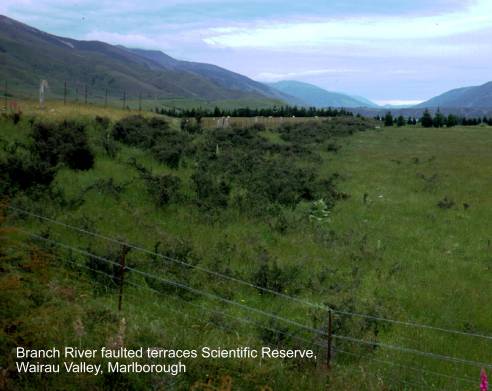
Acheron cob accommodation house,
Awatere cuspate
foreland, northern
Barber Stream rock glacierlandslide.
Map: N29; Classification: C3. Significance: Excellent example of an unusual
feature - a rock glacier.
Blairich solifluction stripes. Map: P29; Classification: B3.
Significance: A fairly extensive area of well defined solifluction
stripes and stone polygons with a large well-shaped cirque.
Blind River Miocene-Pliocene fossil sequence. Map: P29;
Classification: B3. Significance: Excellent exposures of fossil-bearing Miocene
and Pliocene sedimentary rocks.
Bush Gully
faulted slope (Elliot Fault). Map: N31; Classification: C2. Significance:
Largest horizontal displacement measured across the Elliot Fault.
Bush Gully
faulted terrace (Elliot Fault). Map: N31; Classification: C2. Significance:
Largest horizontal displacement measured across the Elliot Fault on a
post-glacial degradational river terrace [12 m RL].
Cape Stephens
wind-funnelled sand dune, D'Urville
Island. Map: P25; Classification: C3. Significance: Unusual landform for the
region.
Cardigan Ridge
fault trace (Fowlers Fault). Map: N31; Classification: C3. Significance:
Largest late Quaternary RL displacement seen on the Fowlers Fault.
Chancet Rocks CretaceousTertiary boundary. Map: P29; Classification:
A1. Significance: Good exposure of the biostratigraphically
determined Cretaceous-Tertiary boundary. Large Paramoudra
trace fossils, previously thought to be fossil sponges.
D'Urville Island copper mines. Map: P26; Classification:
C2. Significance: Northernmost copper mining in the
Endeavour Inlet
antimony workings. Map: P26; Classification: B3. Significance: Site of
the largest antimony mine in
Fighting Bay Torlesse schist. Map:
Q27; Classification: C3. Significance: Exposured
rocks that area a possible extension of the
Fowlers Hut
fault trace (Fowlers Fault). Map: N31; Classification: C3. Significance: Site
where maximum post-glacial displacement has been determined, ie 23-27 m RL. Stream displacement along the Fowlers Fault
(as represented by this, and other Fowlers site)
indicate that at least 2 displacement episodes have occurred. This site is
monitored for precise strain measurements by the Earth Deformation Section,
Hodder River weathering features. Map: O30; Classification:
B3. Significance: Good example of differential lithology
weathering.
Horse Flat coal measure fossils. Map: O31; Classification:
B3. Significance: Only known
Isolated Creek sawcut gorge. Map:
P29; Classification: C3. Significance: A spectacular narrow sawcut
gorge, approximately 30 m deep on Isolated Creek.
Isolated Flat. Map: N30; Classification: C3. Significance: A
large gently sloping mountain flat at approximately 1000 m elevation with
evidence of large scale slumping. The Awatere Fault visably traverses the flat. A unique
landform feature in this area.
Leader Dale
fault offset stream (Clarence Fault). Map: N31; Classification: B2. Significance:
Excellent easily visible example of stream offset laterally by displacement on
a large fault.
Matarau Point
foreland beach ridges. Map: O26; Classification: B2. Significance: Large
and important example of accreted beach ridges which document changing relative
sea levels and longshore drift.
Mt Ears prehistoric argillite quarry, D'Urville
Island. Map: P25; Classification: B3. Significance: Probably the most
northern quarry and an important source for metasomatised
argillite that was to be distributed to the
Needles Point pinnacles and CretaceousTertiary
boundary. Map: P29; Classification: B3. Significance: Good KT boundary
exposures and spectacular coastal erosion features.
Paddock Rocks,
D’Urville Island. Map: P26; Classification: C3.
Significance: Excellent example of the partly eroded crest of a nearly submerged
ridge crest now forming a belt of islets and rocks.
Pakiaka Point
boulder bank and lagoon. Map: O26; Classification: C2. Significance:
Best example of a boulder bank and enclosed lagoon in the area.
Pelorus and
Penk River
Cretaceous olistostromes. Map: O29;
Classification: C3. Significance: Excellent section through olistostromes
and debris flows.
Pyramid Rock.
Map: O28; Classification: C3. Significance: Unusual rocky promintory
sticking out above softer surrounding rocks in melange.
Rarangi beach
ridges and swamp. Map: P28; Classification: C2. Significance: A series
of post glacial beach ridges extending inland about 4 km.
Riverlands sand dunes. Map: P28; Classification: C2.
Significance: Sand dunes marking the arc of the former early Holocene coastline
stretch parallel to the present coast.
Serpentine Creek landslide. Map: N30; Classification: C2.
Significance: An excellent example of a landslide avalanche containing a buried
fossil forest.
Seymour Square War Memorial clock tower. Map: P28;
Classification: C2. Significance: Best example of a war memorial made from
local Marlborough Wharanui stone.
St James
Station fault scarp (Clarence Fault). Map: N31; Classification: C3.
Significance: Well preserved fault scarp showing the largest lateral
displacement on the Clarence Fault.
Staircase intrusion. Map: O30; Classification: B3.
Significance: Best
Starborough
Creek Pliocene fossils. Map: P29; Classification: B3. Significance: Well
exposed section through fossil-bearing Pliocene sedimentary rocks.
Tapuaenuku
zirconium aegirine. Map: O30; Classification:
B3. Significance:
Tarndale flats. Map: N30; Classification: B2. Significance:
An excellent example of an alpine flat with numerous tarns.
Tarndale-Sedgemere fault trace (Awatere
Fault). Map: N30; Classification: C2. Significance: Excellent late Quaternary
traces of the Awatere Fault zone and associated
landforms occurring in a zone up to 2 km wide.
Titirangi
prehistoric stonework. Map: P26; Classification: C2. Significance: The
best example of stone garden walls in the
Tory Channel East Head. Map: Q27; Classification: C3.
Significance: Outstanding section of coastal cliffs with prominent vertical
joints and schistosity giving a pinnacled character. Readily viewed by passengers on
Upton Brook rejuvenation gorge and fossils. Map: P29;
Classification: B3. Significance: Rich fossil site and good example of a
rejuvenated gorge.
Waima dune
field. Map: P29; Classification: C2. Significance: Best example of
coastal sand dunes in
Wairau abandoned sea cliffs. Map: P28; Classification: B3.
Significance: Good example of abandoned sea cliffs and stacks dating back to
the early Holocene.
Wairau boulder barrier, lagoons and delta. Map: P28;
Classification: B1. Significance: One of the best examples in
Wakamarina
alluvial gold mining. Map: O27; Classification: C3. Significance: Good
example of alluvial gold mining, first significant gold discovery in
Waterfall Stream and Cow Stream moraines. Map: O29;
Classification: C3. Significance: Terminal moraines in large blocks. Some of
the best examples of these unusual terminal moraines features.
Unusual so far east of the main range.
Wharanui earth
flow. Map: P30; Classification: C3. Significance: A good example of an
active earth flow.
White Bluff sea cliff. Map: P28; Classification: C3.
Significance: A large dramatic sea cliff overlooking
Woodside Creek Cretaceous-Tertiary boundary. Map: P30;
Classification: A2. Significance: Internationally important locality for
Cretaceous-Tertiary boundary exposure, determined using foraminifera and dinoflagellates and having an iridium anomaly. One of the three first sites in the world where an iridium anomaly
was recognised at the Cretaceous-Tertiary boundary.
As the only southern hemisphere site at the time, it was critical in developing
the hypothesis of a meteorite impact.